The wish to travel seems to me characteristically human: the desire to
move, to satisfy your curiosity or ease your fears, to change the
circumstances of your life, to be a stranger, to make a friend, to
experience an exotic landscape, to risk the unknown.’
This country is broad and the whisper of adventure smiles coyly around
most corners. Weather and politics gets in the way of traveling to many
parts of the country but much of it, with a little pluck and planning,
remains ripe for exploration …
Nagaland
Even in the times of British-rule it was difficult to secure a travel
permit into Nagaland, so it was naturally greeted with excitement by
travelers in Myanmar when the need for such permits disappeared
altogether.
Caught between advancing British imperialism and ambitious Burmese
kings, the Naga fostered a ferocious reputation as they fought to keep
their autonomy. By brute force they were eventually subsumed into the
British Empire. Years later, to great effect they acted as guides and
scouts to the Allied Forces during the Second World War, coming to be
seen by some as not savage headhunters but “extremely lovable.”
Today’s Naga Self-Administered Zone in Myanmar is a strip of land along
the Indian border, with the administrative capital in Lahe, with some
adventurous tourists in Myanmar making it to Lay Shi. The bold may wish
to rent motorbikes; all should travel with a guide.
.

.
Mawlaik
Recently Sampan Travel journeyed down the Chindwin River to Mawlaik.
Today, it is not a town that crops up much in the newspapers nor holiday
brochures however in times past it was an administrative centre of
great import.
The town is peppered with colonial-era mansions, standing vacant and
empty. It was also once the point at which many refugees from Yangon
fled towards the Indian border as the Japanese Imperial Army invaded
Burma.
British teacher U Thant Zin, a local celebrity, can still remember –
and is keen to recount to those interested – of the Japanese soldiers
who later committed suicide in the town as the British were returning,
and the local boys who played football with their heads in the street.
A good spot for mindless wandering and settling down into tea shops. We don’t recommend the golf course.
.

.
The Eng
Kyaing Tong sits in the midst of the Golden Triangle - where Myanmar
meets the borders of Laos, Thailand, and China. Here it is possible to
hike through fields that were not so long ago growing poppies, meeting
some of the most diverse array of Myanmar ethnicities.
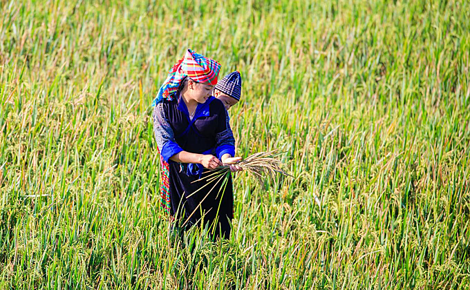
One of the most interesting is the Eng.
In the Eng village you will encounter errant children with pierced
ears, a trusty slingshot in one hand, and wearing – if anything at all –
the traditional black costume of their tribe. Their parents will likely
be off working in the fields, but you can sit a while with the
grandparents, many of whom will have painted their teeth black.
For a while after you leave the village the crackle and snap of twigs
in the underbrush either side of the trekking track behind you will
signal that you are being granted a clandestine escort out of Eng
territory.
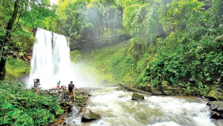
Mawlu & Henu
History wonks may travel up to Kachin State and across to Indawgyi
where ‘Red Shan’ villagers on the banks of Myanmar’s largest lake may
point to the place where fighter planes crashed during the Second World
War.
On the way to or from Indawgyi it is worth visiting the nearby villages
of Mawlu and Henu where during the Second World War, “Mad Mike”
Calvert, after being parachuted in behind enemy lines, set up the
Chindits base “White City.”
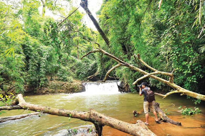
Near Mawlu you can also see the field used as a landing strip and a
commemorative plaque on “Pagoda Hill”. There is also here a small
Chindits museum. It was here that the Calvert’s Chindits made a surprise
attack on a troop of Imperial Japanese soldiers and, in Mad Mike’s own
words:
“…at the top of the hill, about fifty yards square, an extraordinary
melee took place, everyone shooting, bayoneting, kicking at everyone
else, rather like an officer’s guest night.”
.
.
Ye
A few hours drive south of Mawlamyine is the little town of Ye, which
is as delectable and charming as its name suggests. Here is an adventure
for the faint-hearted.
At Ye there is a lake which can take be circumnavigated at a meandering
pace in about an hour, stopping to sit at one of the wonky “lovers’
benches” or take a cup of sweet Myanmar tea under the willows.
A walkway leads out into the centre of the lake. From here you can drop
titbits into the water and watch as a writhing mass of pake fish
emerge, their mouths moronic and gaping and cavernous.
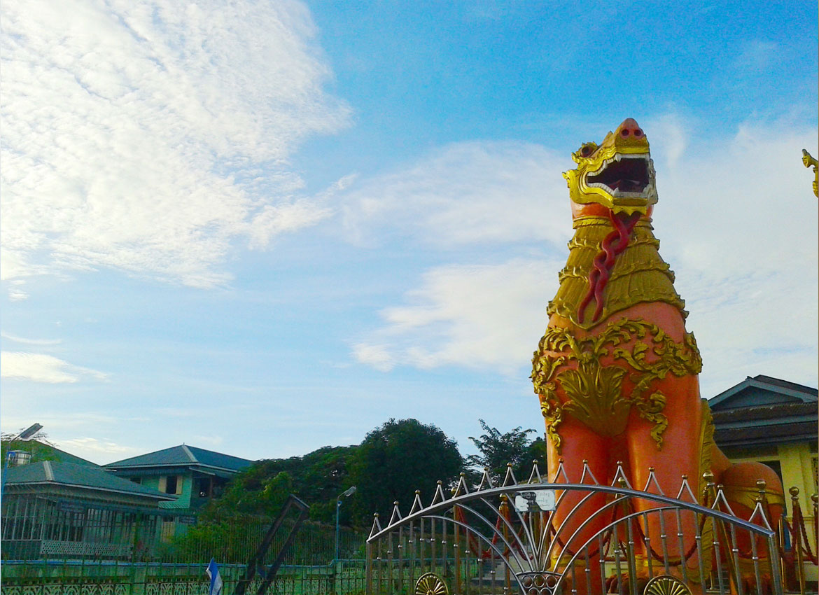
For others, it may be adventure enough to slip into one of the
off-piste beer stations, or sit and watch the world go by under the
chinthe that guard the entrance to the central pagoda, painted in a rich
scarlet.
Source - MM Times