Thursday, October 31, 2019

Thailand - Views from the top

 .
Upgraded from district to a province in 2011, 
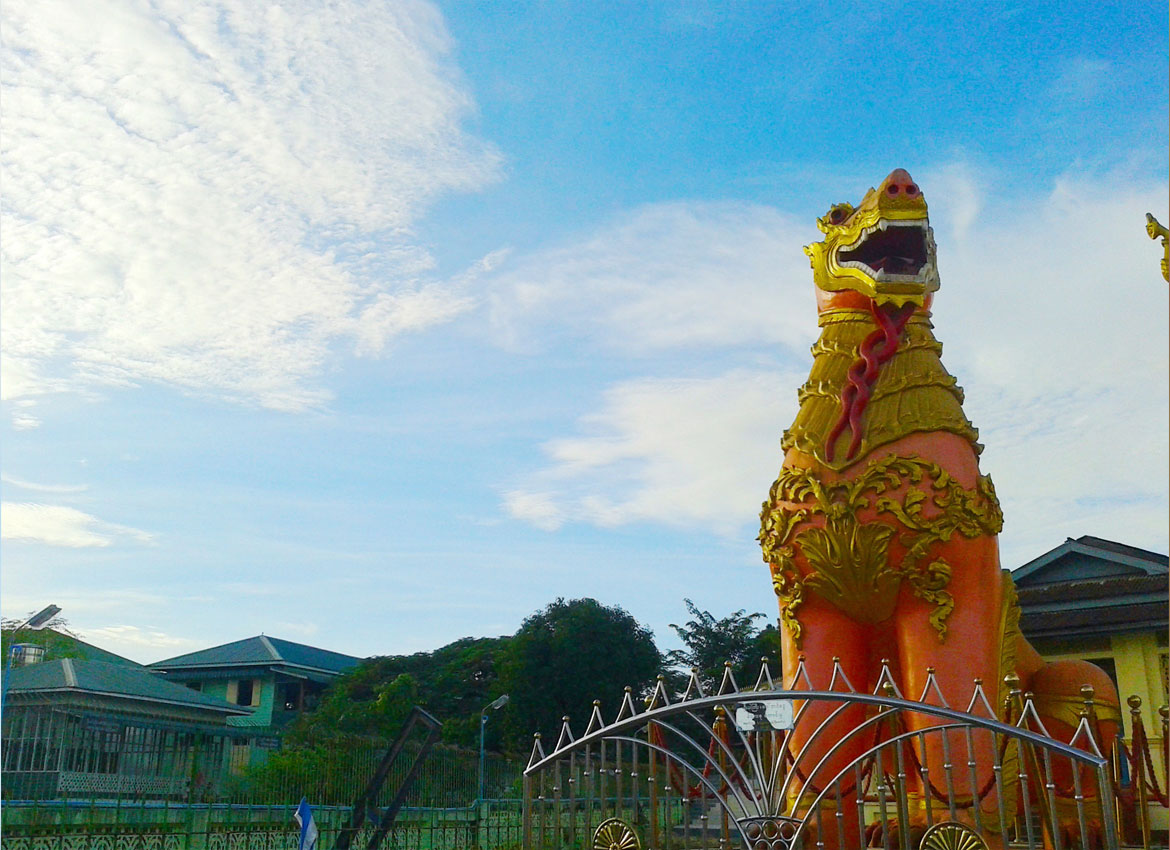
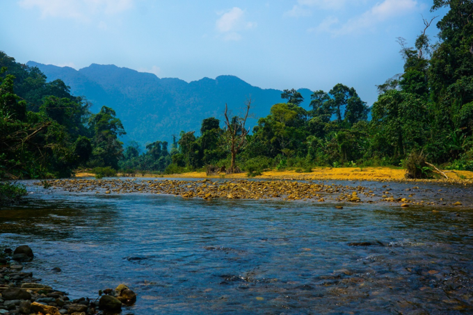
Bueng Kan in Thailand’s northeast is a popular tourism destination thanks to its historical and archaeological sites as well as its celebration of Songkran, the Thai New year, the Rocket Festival and long-boat racing. It’s not short on natural attractions either, among 
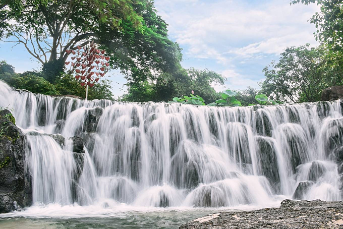
them Phu Wua Wildlife Sanctuary, the Chet Si, Tad Kinari and Tad Wimanthip waterfalls, Bueng Khong Long and Phu Tok.
 
Visitors can also enjoy a taste of Laos in the area where the Mekong River meets our northeastern neighbour’s Borikhamsai District and where another Friendship Bridge will soon be built.

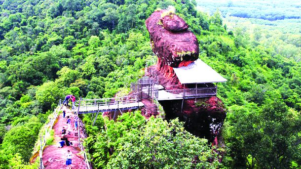
A must-see is Three Rocks Whale or Hin Sam Wan in Thai. Located in a conservation area in the national reserve covering the Kala rainforest, Phu Sing forest and Pink Dong forest, it is made up of three rocks perched on the mountain that are thought to date back some 75 million years. The rocks bear a remarkable resemblance to a family of whales – father, mother and baby – and offer one of the most beautiful viewpoints in Phu Sing. 

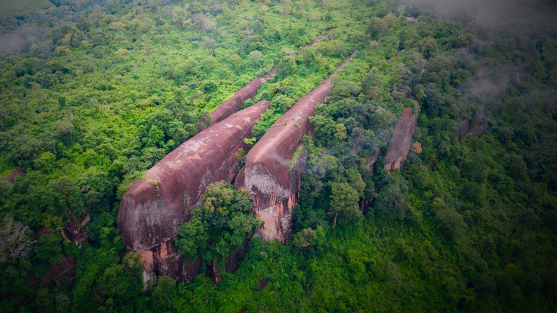
Nearby is the equally impressive Phu Sing rock, the result of a geological change in the earth’s crust and a place of immense natural beauty. Phu Sing has important natural features including the Phu Sing Tham Field, the Lan Tham Viewpoint, Ruesi Cave, Hin Chang, Hin Railway, Lan Hin Lai and Phu Sing Rock Wall.
.
.
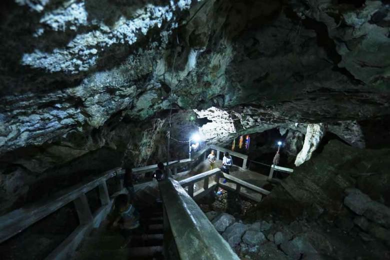
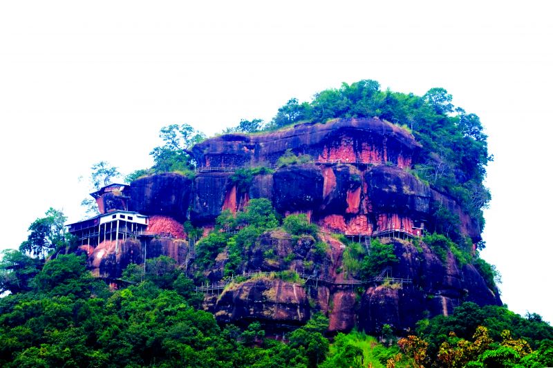
 The high and isolated Phu Thok in Na Sabaeng subdistrict is where you’ll find Wat Chetiya Kiri Wihan or Wat Phu Thok as it is known locally and from here, it’s possible to see the mountains in Nakhon Phanom. Years of manual labour went into the building of a 7-storey spiral staircase which leads to the cloisters and cave. From the top, tourists can see the beauty of the landscape below. The highlight of Phu Thok is the Buddhist temple, which contains the Buddha's relics. It is considered a magical place because when a stone separated from a larger stone, it did not tumble down the hillside and is often likened to Golden Rock Pagoda in Myanmar. Phu Thok doesn’t normally allow visitors but is open to all comers between April 10 to 16 every year. Another must-see is Phu Lanka National Park, a massive area that stretches from Phai Lom Subdistrict in Nakhon Phanom to Bueng Kan’s Seka District.
.
 .
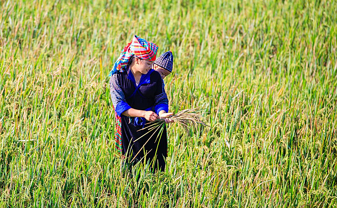
The best time to visit is from May to October when the wildflowers, wild orchids and paphiopedilum are in full bloom at the top of Phu Lanka. Tourists can also explore the nature trail, waterfalls and the Pha Sanga Buddha Cave. Those wishing to climb to the top of Phu Lanka to admire either sunrise or sunset should contact the park’s staff at least 7 days in advance. 

And if you are planning to visit, be prepared for lots of long walks and steep climbs. They are worth every minute of the views you’ll experience.

Source - The Nation

Saturday, October 26, 2019

Micro-adventures in #Myanmar (Burma)


The wish to travel seems to me characteristically human: the desire to move, to satisfy your curiosity or ease your fears, to change the circumstances of your life, to be a stranger, to make a friend, to experience an exotic landscape, to risk the unknown.’

 This country is broad and the whisper of adventure smiles coyly around most corners. Weather and politics gets in the way of traveling to many parts of the country but much of it, with a little pluck and planning, remains ripe for exploration …
 
Nagaland

Even in the times of British-rule it was difficult to secure a travel permit into Nagaland, so it was naturally greeted with excitement by travelers in Myanmar when the need for such permits disappeared altogether. 

Caught between advancing British imperialism and ambitious Burmese kings, the Naga fostered a ferocious reputation as they fought to keep their autonomy. By brute force they were eventually subsumed into the British Empire. Years later, to great effect they acted as guides and scouts to the Allied Forces during the Second World War, coming to be seen by some as not savage headhunters but “extremely lovable.”

 Today’s Naga Self-Administered Zone in Myanmar is a strip of land along the Indian border, with the administrative capital in Lahe, with some adventurous tourists in Myanmar making it to Lay Shi. The bold may wish to rent motorbikes; all should travel with a guide. 
.
.
Mawlaik

Recently Sampan Travel journeyed down the Chindwin River to Mawlaik. Today, it is not a town that crops up much in the newspapers nor holiday brochures however in times past it was an administrative centre of great import. 

The town is peppered with colonial-era mansions, standing vacant and empty. It was also once the point at which many refugees from Yangon fled towards the Indian border as the Japanese Imperial Army invaded Burma. 

British teacher U Thant Zin, a local celebrity, can still remember – and is keen to recount to those interested – of the Japanese soldiers who later committed suicide in the town as the British were returning, and the local boys who played football with their heads in the street. 

A good spot for mindless wandering and settling down into tea shops. We don’t recommend the golf course. 
 .
.
 The Eng

Kyaing Tong sits in the midst of the Golden Triangle - where Myanmar meets the borders of Laos, Thailand, and China. Here it is possible to hike through fields that were not so long ago growing poppies, meeting some of the most diverse array of Myanmar ethnicities. 
One of the most interesting is the Eng.

In the Eng village you will encounter errant children with pierced ears, a trusty slingshot in one hand, and wearing – if anything at all – the traditional black costume of their tribe. Their parents will likely be off working in the fields, but you can sit a while with the grandparents, many of whom will have painted their teeth black.

For a while after you leave the village the crackle and snap of twigs in the underbrush either side of the trekking track behind you will signal that you are being granted a clandestine escort out of Eng territory. 

Mawlu & Henu

History wonks may travel up to Kachin State and across to Indawgyi where ‘Red Shan’ villagers on the banks of Myanmar’s largest lake may point to the place where fighter planes crashed during the Second World War. 

On the way to or from Indawgyi it is worth visiting the nearby villages of Mawlu and Henu where during the Second World War, “Mad Mike” Calvert, after being parachuted in behind enemy lines, set up the Chindits base “White City.” 

Near Mawlu you can also see the field used as a landing strip and a commemorative plaque on “Pagoda Hill”. There is also here a small Chindits museum. It was here that the Calvert’s Chindits made a surprise attack on a troop of Imperial Japanese soldiers and, in Mad Mike’s own words:

 “…at the top of the hill, about fifty yards square, an extraordinary melee took place, everyone shooting, bayoneting, kicking at everyone else, rather like an officer’s guest night.”
.
 .
Ye

A few hours drive south of Mawlamyine is the little town of Ye, which is as delectable and charming as its name suggests. Here is an adventure for the faint-hearted.
At Ye there is a lake which can take be circumnavigated at a meandering pace in about an hour, stopping to sit at one of the wonky “lovers’ benches” or take a cup of sweet Myanmar tea under the willows. 

A walkway leads out into the centre of the lake. From here you can drop titbits into the water and watch as a writhing mass of pake fish emerge, their mouths moronic and gaping and cavernous. 
For others, it may be adventure enough to slip into one of the off-piste beer stations, or sit and watch the world go by under the chinthe that guard the entrance to the central pagoda, painted in a rich scarlet. 

Source - MM Times 


Monday, September 23, 2019

#Vietnam - Photographers flock to Yen Bai golden terraces


When the mature rice crop in the northern Vietnamese province’s vast fields turns yellow, the sight is breathtaking. 
.
.
 Photographers also visit other famous locations like Lam Mong and Lam Thai villages, Cao Pha Valley and Khau Pha Pass.

Between mid-September and early October is the time when photographers from across the country visit Yen Bai to take photos of the ripening rice crop.
.
.
This fields, in Han Xung Village of La Pan Tan Commune, has become a symbol of Mu Cang Chai, making it a must-visit destination for anyone who visits this upland area.

 The fields is located around 1 km above sea level and 10 km from Mu Cang Chai District.

 "The process of hunting for photos during the rice ripening season helps photographers blend with nature and make new friends and share their passions about photography," the photographer said.

 First time visitors to Mu Cang Chai should rent a motorbike and hire a porter or other locals to show them the spots with the best views.


Source - VN Express

Tuesday, September 3, 2019

#Vietnam - Five holiday destinations within reach from Saigon Places

.
 Suoi Mo Park, Dong Nai

About 100 km from downtown HCMC, this park is located in Tra Co Commune, Tan Phu District, Dong Nai Province. A good choice for a day trip, it has a natural lake created by the convergence of streams flowing from surrounding hills that cascade over a rocky area. 
.
.
 You can swim, camp, enjoy a BBQ party and so on at Suoi Mo Park. Admission costs VND120,000 ($5) for adults and VND70,000 ($3) for children under 1.3 meters. Visitors are not allowed to bring in their own food, but the park has restaurants with affordable prices.

For this National Day (September 2) holiday, the park is serving a lunch buffet of 60 dishes for VND199,000 ($8.5) per adults and VND109,000 per children ($4.7). The buffet will be served from 11 a.m. to 2 p.m. on September 1 and 2. 
.
.

Thursday, August 22, 2019

#Cambodia - Former ‘killing caves’ become a sobering tourist destination


Phnom Sampov consists of many mountain caves attracting tourists from around the world. But their natural beauty today contrasts with their grim history as Khmer Rouge-era “killing caves”.

Among them is Pka Sla cave, Chest Pounding cave and the Bat cave, where thousands were killed under the Pol Pot regime, with the bones of victims today kept in a glass stupa for display. 

Guide Soung Sitha accompanies visitors to the historic caves, starting with Laang Teng Kloun (Beautified Room Cave) where he points to a case displaying the clothes of victims: “Here we keep victims’ remains, especially clothes worn by people under the Pol Pot regime. They were well-educated people.” 

Leaving Laang Teng Kloun and visiting nearby Laang Lkoun, visitors are greeted by a large golden Buddha reclining next to a stupa full of bones, while a picture depicting victims being thrown from a cliff down into the dark abyss below, as occurred in the cave during the Khmer Rouge era, sits on the wall. 

Grade 5 student Sok Sonita serves as an amateur local guide for children. She takes time from her studies to tell tourists about the history of the caves.

“I can speak a little English and can tell foreigners about the killing and bludgeoning. This was the place they [Pol Pot’s comrades] hit people from above and let them fall. They were well-educated people. I earn irregular money as some days I get a very small amount or nothing, and some days I earn $10,” she said. 
.
 .
Phnom Sampov, 12km west of Battambang, is also the locale for a Homeric Khmer legend in which the machinations of a sentient crocodile were foiled by the stroke of a maiden’s hair.
Mok Sinnara, Battambang provincial tourism department’s former director, told The Post: “The legend goes that Sampov mountain was formed when prince Reach Kol’s sailing junk, carrying dowry in order to marry princess Romsay Sok, was immersed by her crocodile named Athun and became Sailing mountain. 

“The dowry was littered around and became Chicken Cage mountain, Duck Cage mountain and the location where princess Romsay Sok stroked her hair became Romsay Sok mountain. Moreover, when the water went down, Athun’s body became Crocodile mountain. 

“Here at Sampov mountain, where the Romsay Sok temple sits, there are many caves. We think that the Beautified Room Cave is where Romsay Sok dressed up and waited for the prince Reach Kol.”
.
 .
But today, it is survivors of the Khmer Rouge era that visit the caves to pay their respects.
“A few months ago, survivors visited the homeland and conducted a Buddhism ceremony to offer deeds for dead people. They cried remembering the things that happened to them,” said Sitha, who is among four guides who work at Sampov mountain. 

Sitha estimates that some 10,000 victims were killed around the mountain, with trucks full of bones transported to museum.

The caves are located at the peak of Phnom Sampov, in Phnom Sampov commune, Banan district along National Road 57. The entire complex is comprised of 12 caves that can be explored.

Source - PhnomPenhPost

Friday, March 22, 2019

#Vietnam - Kon Tum province urged to develop tourism


NATIONAL Assembly of the Socialist Republic of Vietnam chairwoman Nguyen Thi Kim Ngan has urged the Central Highlands province of Kon Tum – which borders Cambodia and Laos – to restructure its economy to tap tourism potential.

At a working session with provincial authorities on Monday, Ngan also asked the province to increase information technology use in developing agriculture and to form specialised production zones to develop key agricultural products.

Stressing that the Central Highlands was one among key strategic regions of the country, she instructed the province to continue implementing plans to ensure national defence and security and social order.

The NA leader applauded recent achievements by the province, including a Gross Regional Domestic Product (GRDP) growth of 9.28 per cent last year, surpassing the yearly target.
Apart from rubber and coffee production zones, the province has developed other specialised areas for the cultivation of many kinds of fruits and herbal medicines, which have helped attract investors.

Kon Tum province has devised resolutions defining its three key economic zones which attracted 39 investment projects last year with total registered capital in excess of 508 billion dong ($22 million). However, she noted the province still had difficulties, including human resources quality failing to meet development demand and low competitiveness.
.
http://www.agoda.com?cid=1739471
.
Chairwoman Ngan agreed with the province’s proposal to prioritise funds for poor localities along border areas to help them enhance ties with localities of other countries, particularly of Laos and Cambodia.

The top lawmaker stressed it was the state’s policy to encourage cooperation in economic development in border areas and support disadvantaged provinces in carrying out socio-economic development tasks, contributing to improving the living conditions of residents in border areas.

She also agreed with the need to implement key projects to prevent landslides and flood for ethnic minority people living along Kon Tum province’s Dak Bla River.

Kon Tum province is a mountainous border province with a total population of 520,000 from 30 ethnic groups. Ethnic minority people make up more than 53 per cent of the population. VIET NAM NEWS/ANN

Source - PhnomPenhPost
.

Friday, March 1, 2019

#Vietnam’s Kingdom of Caves launches river tour

A boat cruises along the Son River to the Phong Nha-Ke Bang National Park in Quang Binh Province

 Quang Binh taps yet another tourism strength with a river tour through its natural landscapes and traditional villages.

The tour, starting February 20, is organized by Oxalis, the only company licensed to offer adventure tours to the world famous Son Doong Cave.

The one-day tour is boat ride that explores hidden gems along the Son River and enables visitors to visit  traditional craft villages that produce rice paper and the non la (conical hat), a Vietnamese cultural symbol.

Tourists will also have a chance to ride bicycles past small villages to the Phong Nha-Ke Bang National Park, a world heritage site and a major tourist attraction in the central province.
.
http://www.agoda.com?cid=1739471
.
  Each tour is limited to around 15 passengers, said Nguyen Chau A, general director of Oxalis.

Son Doong, part of the Phong Nha-Ke Bang National Park in central Vietnam, has hogged the international spotlight since it opened to tourists in 2013, four years after members of the British Cave Research Association finished their exploration and declared it the world’s largest.

Local resident Ho Khanh first discovered the cave in 1991, and rediscovered it almost 20 years later, opening it up for exploration.

Last year, Quang Binh welcomed a record-breaking 3.9 million tourist arrivals, up 18 percent from the previous year.

The province has over the past years proposed several developments, including a cable car system to boost tourism in the area, but these have met with strong opposition from environmentalists and the public.

Watch a video on the beautiful Tu Lan Cave in Quang Binh, known now as the Kingdom of Caves.
.
 .
Source - VN Express
.
https://www.hotelscombined.com/?a_aid=145054